Tag Archives: New Zealand

Auckland

Sunrise in Waitamo, New Zealand

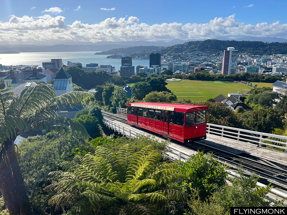
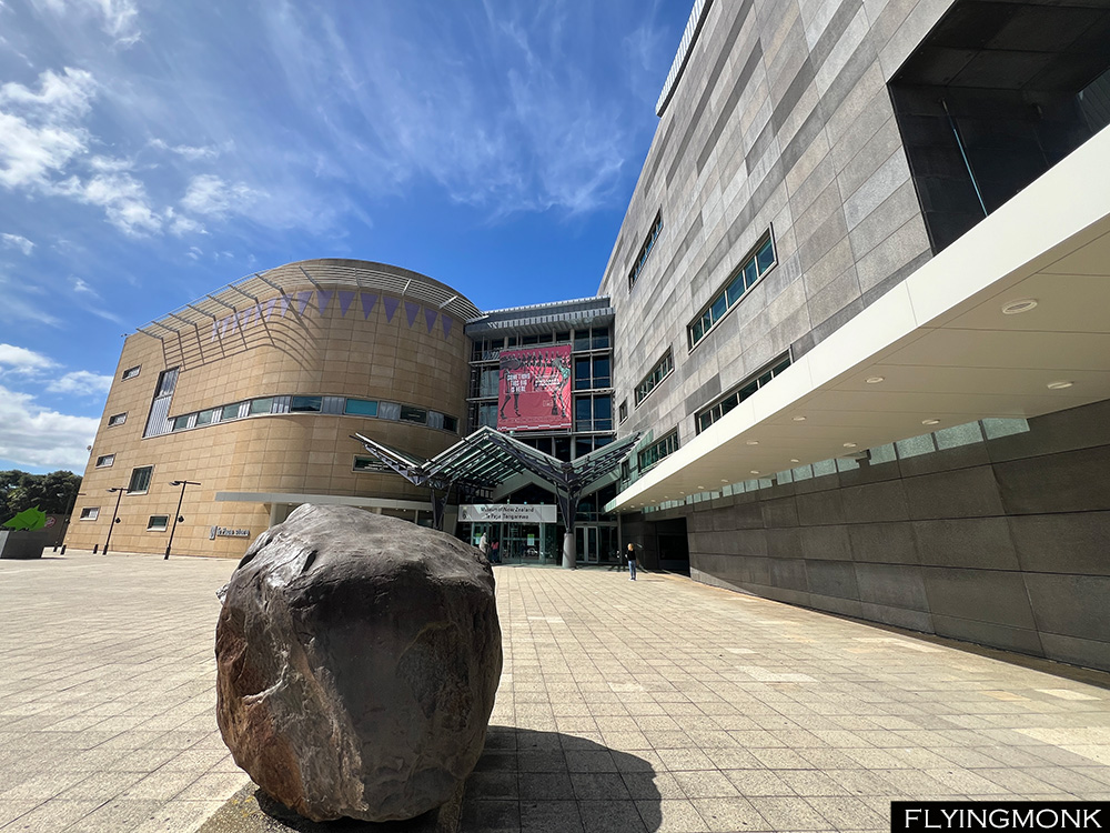
Pure beauty, wonder and reverence. Hiking in New Zealand fills you with a deep admiration for the display of beauty nature can offer. Besides you develop a profound appreciation and respect for the remarkable stewardship and care the kiwis have for their country and its spectacular landscapes. When hiking on the numerous national park tracks a flash of artificial color left on the ground strikes your attention making you stop. It’s just a tiny bit of blue plastic or maybe a piece of a bag taken by the wind but you are baffled because this is such a rare occurrence and for a moment you feel that you discovered a new world, a world of what we call civilization, that unraveled in front of you by accident. But you may hike days in a row and you may not see any trace of human civilization in spite of the hoards of tourists that tramp New Zealand’s national parks.

In a recent story published in New York Times, Frank Bruni tells how the captain of the catamaran he was on, dove in the water to recover a beer can that he saw floating by the shore 50 feet away. This is the New Zealanders’ profound respect for nature and guardianship of the environment.

Sunrise in Waitamo, New Zealand

Most of the trails that traverse the alpine land have a boardwalk covered in a wire mesh helping hikers to navigate the wet portions of the track but also protect the fragile ecosystem. Numerous huts pepper the mountains, simple cabins with spotless bunkbeds that must be booked in advance manned by a ranger looking like taken from Lord of the Rings. On all trails we tramped we could see traps for rodents and weasels that weren’t indigenous to New Zealand who imperil the birds habitat by attacking the nests and eating their eggs. Some trails were closed for repair if the rangers felt their condition not perfect. The same for the roads that all seemed in permanent process of active repair with one man or a light controlling the traffic while others laying new pavement on parts of the road that would be considered very good in many other countries.

Some trails were closed because helicopters were spraying a treatment against the rodents while other helicopters were helping chop dry trees, eyesore in manicured botanical gardens. But helicopters and small planes were everywhere landing tourists on glaciers for a quick photoshoot or surveilling canyons and mountains peaks in short trips from most of the towns.

Auckland, New Zealand

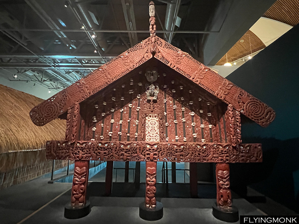
Hundreds of clusters of planted saplings cover entire hills or small patches of land, their fragile trunks protected by plastic cylinders that you could see from far away. They seem another trace of the out-of-place human civilization in that primeval natural environment, but also a very useful one fighting deforestation. The Maori stewardship most probably temperated the Pakeha‘s drive for development but together they were able to forge a national consciousness that helped preserve the treasure they all inherited in this magnificent land. And that consciousness expanded to the kiwi’s way of life, calm and relaxed and eager to have a chat wherever you find them. And for a chat a good cup of coffee was available everywhere. All supermarkets and all gas stations have baristas that would make you the best possible cappuccino you ever had with the tastiest beans that you’d hardly been able to find in our fancy American coffee places. A BP gas station coffee beats all and they are spread all over New Zealand.

Auckland Harbor, New Zealand

I wanted to stay longer in the Pacific but after a month of continuous hiking I felt that it may be enough and I rather return home. After two weeks hiking in Tasmania I was starting to think how I would feel after another two weeks of intense hiking in New Zealand and decided to buy my return ticket, a 15-hour direct flight to JFK from Auckland. It turned out that was a good move because when flying to New Zealand from Sydney, Qantas wanted to see my return ticket from NZ without which they would have refused to let me board the plane. The flight over the Pacific was the most bumpy I ever encountered; you could not sleep and you could not work because you could not keep a steady hand on the keyboard and I was longing to finally see the plane over Mexico’s Baja California where I was sure the turbulence would end. But in the end there were only 15 and not 34 hours as my incoming flight to Tasmania…

Auckland Harbor, New Zealand

.

Boiling

Waimangu Volcanic Valley, Rotorua, New Zealand

Waimangu Volcanic Valley stands proof of the power of the boiling magma. The crater lake boils raising vapors that float like a veil of clouds on its surface offering a surreal image from above. The 3-mile hike along this boiling valley is done only one way. At the end the trekkers are picked by a bus and returned to the visitor’s center.

Waimangu Volcanic Valley, Rotorua, New Zealand

Waimangu is a Maori controlled valley. The hike is paved and the park has an entry fee like many of the similar “attractions” around Rotorua. Besides the main track there are several other trails to walk along the river where steam and hot water sprout from the ground bringing up minerals that color the land in an artist palette.

Waimangu Volcanic Valley, Rotorua, New Zealand

The Tainu iwi settlement opened opportunities for the Maori who embarked on a journey of economic empowerment, establishing a commercial framework that manages its tribal assets. There is a billion dollar Tainui Group Holdings and Waikato–Tainui Fisheries that do business with an emphasis on preserving the tribal tradition and cultural heritage, halting the unchecked development that happen in many other parts of the world.

Waimangu Volcanic Valley, Rotorua, New Zealand

Mount Tarawera is known in New Zealand for its cataclysmic 1886 eruption when the towering ash column rose ominously, reaching heights of 10 kilometers. Earthquakes and thunderous explosions reverberated throughout the region. A rift, stretching 17 kilometers in length, tore through the mountain and surrounding terrain burring villages and changing the landscape. The pink and white terraces, once the crowning jewels of New Zealand were swallowed by the earth and Lake Rotomahana that expanded in the aftermath of the eruption.

Tarawera Volcano and Lake Rotomahana, Waimangu Volcanic Valley, Rotorua, New Zealand

We left Rotorua and drove to our last stop in Waitamo, a place with several glow worms caves just to find all their visiting slots sold out for a week in advance. So we settled for PiriPiri cave with its collection of stalactites and less glowworms during the daylight. However the main drawing point of staying overnight in Waitamo was Ruakari Bush Walk, a forest trail where you could see pockets of glow worms glittering in the night. We found the trail fenced for repairs but we walked around the fence and were able to admire the tiny dots of light hanging from the wet rock. But more light dots we discovered driving back to Waitamo on the phenomenal view of the southern sky and the Milky Way where in the middle of nowhere no specular light would touch the night sky.

Milky Way, Waitamo, New Zealand

Mordor

Mount Ruapehu, Tongariro National Park, New Zealand

The Ring was forged within Sammath Naur, the Chamber of Fire, deep within Mount Doom, the volcanic stronghold of Sauron who projected into its essence his formidable might. Mount Doom, the heart of Mordor is Tongarino National Park’s Mount Ngauruhoe, a lava-covered conic volcano considered sacred by the Maori. In their tradition, Mount Ngauruhoe, whose name translates as “peak of Uruhoe,” pays homage to a slave sacrificed by the high priest of the Arawa canoe, to procure mana (spiritual power) for a sacred fire supposed to arrive from Hawaiki.

Alpine Crossing, Tongariro National Park, New Zealand

On a more mundane tone both Mount Ngauruhoe and Mount Ruapehu could be admired from the famous Alpine Crossing, a 20 km/6-8 hours hike in Tongariro National Park considered the best hike in New Zealand. But the weather that looked great the previous evening conferring great views over the Mount Ruapehu turned cloudy and we barely been able to see only occasionally and only in the morning the top of some surrounding peaks after which the clouds descended covering everything around. The hikers descending from the top came drenched straight from the cloud which veiled them completely in a blanket of drops and advised us not to continue.

Western Prickly Juniper

So instead of one long hike we settled for two shorter ones. Soda Springs Track, 6 mile-return, the first part of the Alpine Crossing was covered in atmospheric, but not so wet clouds. The trail goes through a valley covered by huge lava boulders rolled there from the last eruption of Mount Doom/Ngauruhoe. No, not the one from the movie though…

Soda Springs, Tongariro National Park, New Zealand

Mount Doom/Ngauruhoe is considered a separate mountain but it is actually the second vent of Mount Tongariro. It first erupted 2500 years ago and more recently in 1977.

Silica Rapids, Tongariro National Park, New Zealand

For the second hike we picked Silica Rapids, a hike to a river covered in silicas that winds down through the valley. The hike starts from the main road and can loop towards the village.

Whakapapa, Tongariro National Park, New Zealand

But again with limited time we set for a return hike (3 mile-return) and more exploration on the road that climbs the mountain to the ski resort built on top.

Tawhai Falls, Tongariro National Park, New Zealand

Te Papa

The Cable Car, Wellington, New Zealand

Wellington, New Zealand’s capital, is the country’s third largest city with about 200000 inhabitants. It’s a quaint place in accord with the rest of the country. We came here less for exploring a New Zealand city but to visit its fascinating museum Te Papa, the National Museum of New Zealand.

Botanical garden, Wellington, New Zealand

But as long as we were here we took the cable car and viewed the city and its harbor from above. From the Kelbum suburb we descended the hill through the Botanical Garden where we witness how crews were felling a gigantic dry tree, removed piece by piece by … helicopter. They were cutting one piece, anchor it, the chopper would lift it and dispose it a bit further down. As the garden attendants were saying, this would chew a big chunk of the yearly tree budget.

Parliament, Wellington, New Zealand

The New Zealand’s Parliament can be easily visited by a tour or simply you can walk to the gallery and watch the ongoing session debates session. But it took quite a while to grasp the kiwi accent…

Wellington Harbor, New Zealand

Te Papa offers a great first lesson in Aotearoa culture. The Maori name of New Zealand seems to stem from the first word that was pronounced when the first migrants saw the island while sailing in the Pacific. It appeared to them as a “long cloud” – Aotearoa.

Te Papa, The National Museum of New Zealand in Wellington

The first settlers of the land we know today as New Zealand migrated from Polynesia and became the Māori. The lineage of these ancestors traces back 5,000 years to indigenous peoples in Taiwan. From there, Polynesian people dispersed across a vast area, including Tonga, Samoa, Tahiti, Hawaiʻi, Easter Island (Rapa Nui), and eventually New Zealand.

Credit: Wikipedia

It is not known precisely when Maori settled in Aotearoa but the Maori oral tradition mentions a grand migration between 1320 and 1350 that originated in Hawaiki, that is associated with Tahiti. In the Māori mythology, Hawaiki has its special place. It is known as the realm where Io, the supreme being, shaped the world and its first inhabitants but also it represents the ultimate destination of each individual soul after death.

Food House in Te Papa, The National Museum of New Zealand in Wellington

Some researchers mention of a possible early Māori settlement in the north island between AD 1250 and AD 1275. In any case it is known that in 1315 Mount Tarawera viciously erupted changing the landscape of the north island. The main settlement period is believed to have occurred in the decades after the Tarawera eruption. There are also speculations that Maori seafarers have been the first humans to discover Antarctica.

Crossing

East Coast drive to Picton, South Island, New Zealand

Our time in New Zealand’ south island was coming to an end. Today was our tenth day in the south island and we barely scratched the surface saving only 5 more days for the north island. On the way from Timaru, we stopped a bit in Christchurch and continued on the east coast towards Picton. The spectacular drive follows almost in its entirety the shore, an almost 5-hour drive towards the ferry.

Picton Harbor, New Zealand

Picton’s harbor is surrounded by peaks. The Cook Strait that separates the two islands is formed on its southern side by a collection of fjords from where sailboats or tugboats came out in the caressing sunset. It took more than 90 minutes to reach the end of the fjords and entered the open sea towards the north island. The entire crossing took about 3 hours and ended up in Wellington harbor in close proximity to the city center.

Picton Harbor, New Zealand

In Māori legend, the North Island, named Te Ika a Māui represents Māui’s fish, while the South Island named Te Waka a Māui symbolizes Maui’s waka (canoe). The waka is anchored by Stewart Island-Rakiura translating as “Māui’s Anchor Stone.” . As the story goes, Māui, armed with an ancestral jawbone hook, hauled a colossal fish from the depths of the sea with the help of his brothers. Together, they hoisted the fish to the surface, forming the South Island, which served also as their vessel.

Cook Strait, New Zealand

According to the Ngāti Porou tribe of the East Coast, their sacred mountain, Hikurangi, was the first part of the fish caught by Maui to emerge from the water. They believe that Māui’s canoe, Nukutaimemeha, became stranded on Hikurangi and remains there in petrified form.

Sunset in Cook Strait, New Zealand

Lake Tekapo

Mt Cook, Aoraki National Park, New Zealand

The powerful wind that blew yesterday in Hooker Valley was a sign of a long announced incoming storm. We hoped that the storm front will move quickly but it was there to stay and the morning Twizel was covered by clouds. On the top picture is the previous day’s Aoraki view and on the bottom picture is the today’s view.

Lake Pukaki, New ZealandThe

The menacing storm clouds were in deep contrast with the emerald color of Lake Pukaki’s surface lit by the sun rays. So we had to bail out of other hikes around Aoraki and we settled for a very domestic walk in Twizel when somehow the sun was able to shine through the clouds in spite of the neighboring storm.

Lake Tekapo, New Zealand

For the second part of the day we went for Mount John Circuit by Lake Tekapo, a 6 mile hike with magnificent views over the lake and its islands. According to Māori lore, Lake Tekapo, or Takapō, is related with two iwi chiefs who, rushing to depart by night from the lake were caught by the rising sun and somehow transformed into two pillars that now guard Lindis Pass’ entrance. The word “Takapō” comes from the Māori words “taka” (sleeping mat) and “pō” (night), evoking the notion of hurried departure under cover of nightfall.

Lake Tekapo, New Zealand

The hike by the lake climbs all the way to the peak of the hill that has on top an astronomic observatory and continued from there by descending towards the lake. There are no other legends on the path, just great beauty. Lake Tekapo town was packed with tourists who were pacing a beautiful promenade by the lake, a charming walk that ends by the Church of Good Shepard, dedicated “to the glory of God and as a memorial to the pioneers of the Mackenzie Country”.

Church of Good Shepard, Lake Tekapo, New Zealand

Aoraki

Hooker Valley Track, Aoraki National Park, New Zealand

While moving in the southern island you gyrate around Aoraki/Mount Cook. It’s always there but somehow unreachable. To come close to it you have to go around the entire western mountain chain and drive the last leg from Queenstown along the celestial blue surface of Lake Pukaki.

Hooker Valley Track, Aoraki National Park, New Zealand

And if the weather cooperates Aoraki would shed its mysterious veil and you could see it from far away in its full splendor. The most beautiful hike towards the peak is Hooker Valley, an 8 miles/3 hours return hike. It crosses three times Hooker River following along its waterbed on three suspended bridges that sway precariously in the gusty winds.

Hooker Valley Track, Aoraki National Park, New Zealand

It was sunny but the wind was ferocious swinging the bridges and scaring the hikers who felt their wobbly stepping on the bridge unsafe. The clouds seemed to stand still on top of the adjacent peaks in spite of the blustery wind but the forecast mentioned an incoming storm that was supposed to be bring rain the next day. So the wind was just the preamble of the menacing storm.

Hooker Valley Track, Aoraki National Park, New Zealand

However the wind or the incoming storm did not stop anybody’s hike towards the peak. The trail is quite easy, the elevation gain less than 300 meters, and as a result it was the most crowded trail I ever encountered anywhere even if you count the Manhattan’s Central Park’s alleys. It seemed that everybody and all their aunts were there. However the hike was rewarding even in the tempestuous wind with Aoraki glittering in the sun peeking out of the landscape for the entire hike. We would have liked to continue the hike even further following the contour of its base lagoon filled by ice floats but the wind whispered that is better to give up and just sit at the base of the mountain and enjoy its splendid view furtively offered. It was a gift that will soon be veiled by the incoming storm.

Mount Cook, Aoraki National Park, New Zealand

According to the ancestral legends of the Ngāi Tahu iwi, Aoraki and his three brothers trace their lineage to Rakinui, the Sky Father. The siblings descended from their celestial realm in a majestic canoe to visit Papatūānuku, the Earth Mother, and embark on an expedition across the vast expanse of land and sea. During their voyage, tragedy struck as their waka (canoe) foundered upon a treacherous reef, forcing the brothers to seek refuge atop the vessel’s upturned hull. Their fishing endeavors proved fruitless and hunger soon gnawed at their spirits compelling them to contemplate a return to the heavens, to the sanctuary of their father, Rakinui.

Mount Cook, Aoraki National Park, New Zealand

Aoraki had to initiate the sacred incantation to launch their colossal waka back towards the cosmic expanse, but in this critical moment, his courage faltered, and he hesitated to utter the final words that would liberate them from the earthly realm. Exposed to the merciless chill of the southern winds, Aoraki and his two other siblings turned into three majestic towering mountains and the canoe itself metamorphosed into the South Island.

Mount Cook, Aoraki National Park, New Zealand

Isengard

Moke Lake. New Zealand

There are lots of things to do in Queenstown and our original plan was to climb Ben Lomond Peak but that would have taken the entire day. After a lot of back and forth we set for a more down to earth hike around Moke Lake, a 3 hours loop in order to have time and do some other things during the day.

Lake Moke, New Zealand

From Moke Lake we continued north towards Glenorchy following the shore of Lake Wakatipu. There are several choices of hikes on the way but with, again, limited time we chose Bob’s Cove Lookout.

Lake Wakatipu, New Zealand

In Maori language, Bob’s Cove is called the “sacred pool”, Puna Tapu, and it was an important place for ceremonies. The hike is not long following the contour of a peninsula that you have to circle around only because it is not trail going straight up to the viewpoint that is actually very close.

Bob’s Cove Lookout, New Zealand

For the English, Bob’s Cove was named after Bob Fortune, a commander of William Rees’ boat who was an explorer, surveyor and one of the first settlers in the Otago province of New Zealand. He is considered the founder of Queenstown and his statue adorns the pedestrian area of the town. The cove was looked after and always used by Captain Bob Fortune who hid his boat from storm inside its protected shores.

Little Paradise, Glenorchy, New Zealand

We found Thomas’ Little Paradise on Atlas Obscura and we were the only visitors. A real tiny piece of paradise created by this Swiss with his own hands in the place where he moved 40 years ago. The beautiful and diverse garden impeccably maintained has lots of sculptures created by him. The entire property lays smack on the 45th parallel of the Southern hemisphere that is marked with a line made out of stones.

Little Paradise, Glenorchy, New Zealand

His house is a work of art as well completely built and decorated by him with log carved furniture and flooring, weavings and wall paintings that we wished we knew about before we booked our Queenstown’s apartment.

Little Paradise, Glenorchy, New Zealand

But more than anything Thomas is quite a character whom we spent more than one hour chatting about the way he sees the world, NZ and American politics all with a world view upon events. We wished we could stay and chat longer but the day was going toward sunset and we had still to drive to Glenorchy, 20 km away.

Isengard Lookout, Glenorchy, New Zealand

And finally we made it to Isengard, where the Númenóreans in exile built the fortress meant to protect Gondor’s northwest border. Actually Glenorchy/Isengard is a charming place where Daart River flows into Lake Wakatipu. But the heavy clouds brought a menacing look to the Lord of the Ring’s citadel location and we had to leave fast not to get drenched but it ended up not raining at all. Daart River is the conduit towards Te Koroka, a mountain in Mount Aspiring National Park with lots of pounamo, the jade-like greenstone coveted by the Maori and abundant in this part of Aotearoa, as the Maori call that land we know as New Zealand.

Sand Flies bites

There is only reason that may make you want leave New Zealand’s west coast: the sand flies. Small gnats that will land anywhere on you and pinch almost imperceptibly. You may not even notice them sometimes but you will wake up in the middle of the night and scratch yourself to oblivion. And the bites will stay there for weeks and still hurt. In Maori the sandflies are named namu and are a species of blackflies. So be aware and cover yourself if you don’t have any insect repellent.

The Giant’s Heart

Takahe, Te Anau Birds Park, New Zealand

With limited time in New Zealand you always have to compromise between destinations. There is a large number of day-hikes to chose from in Milford Sound and with the time needed to cover the distances we were able the previous day to squeeze only the Key Summit hike besides the mandatory cruise on Milford Sound.

Sheep Farm, New Zealand

And we were able to do this only by spending the second night in Te Anau where is a great bird conservation park where we were able to see the almost extinct Takahe. Otherwise lots of sheep, pig, cow, deer and lama farms on the road to Queenstown. New Zealand is full of farms everywhere you drive.

Lake Alta, Queenstown, New Zealand

The drive from Te Anau to Queenstown takes about two hours with no stops. After arriving in town we went straight to the Remarkables paid road that takes you in steep hairpins all the way up to the ski lifts base. From there the hike climbing partially the ski slopes takes you to Lake Alta, an eye of emerald water surrounded by dry metamorphic rocks with intricate design pushed up by the earth pressure.

Lake Alta Rocks, Queenstown, New Zealand

While basking in the tranquility of the serene environment of the lake we were rattled by a helicopter sound above. In spite of the deafening noise it was interesting to watch how the “kiwis” were building a new ski lift, the entire work done by helicopters hauling materials. A country with too few people, 5 million over an area larger than UK, but with good technology.

Queenstown, New Zealand

Queenstown sits on the shore of Lake Wakatipu known in the Maori legends as the “hollow of the sleeping giant”. It’s a legend about the secret love between Matakauri, a young warrior, and Manata, the daughter of a Māori chief. One night, Matau, a giant taniwha, sort of a troll, kidnaped Manata and hid her in his mountain lair. This was the chance of Matakauri who went after Matau, killed him and rescued and married the poor girl.

Lake Wakatipu, Queenstown, New Zealand

The body of the dead Matau troll burned a hole in ground soon filled by water, forming the large “S” shaped Lake Wakatipu. Matau body has his head at Glenorchy and his feet at Kingston while Queenstown sits on the knee of the giant. Matau’s heart is the only part of him that still exists, and it beats in the lake, causing the water level to rise and fall by 20 centimeters every 27 minutes. This phenomenon is called a seiche, which is caused by wind and atmospheric changes. Some say that the Hidden Island across the lake from Cecil Peak is the still beating heart of the giant Matau.

Sequoia Tree in Queenstown Gardens, New Zealand

Fjordland

Mirror Lakes, Milford Sound, New Zealand

The southern part of the Southern island is in a way the climax of a trip to New Zealand. Fjordland’s beauty is unmatched. The drive through Fjordland to Milford Sound it’s considered the most scenic drive in the entire country and there are so many places to stop that you wonder how you would be able to see everything. In order to have time to explore Fjordland we decided to spend two nights in Te Anau and it proved a wise decision not adding two more hour drive to Queenstown.

Fjordland, New Zealand

From mind boggling views of peaks among peaks hanging from the sky, to magnificent waterfalls, to endless plains squeezed by mountains, to lakes perfectly reflecting the surrounding peaks, to inviting tracks winding to surrounding tops and a mysterious tunnel the road to Milford Sound is a collections of places so alluring that you feel that you’d never have time to reach its end.

In 1973, John Williams, a geology student – now professor – at the University of Otago, inspired by Tolkien’s “Lord of the Rings” suggested a list of new names for places in the Fjordland. Among his naming was Mt Gondor, Rivendell Pass, Westernesse Pass and Mordor Peak. He also renamed two peaks, Sauron Peak and Isengard Peak. The park administration rejected the whimsical suggestions as not being in tune with their naming scheme.

Fast forward some decades here comes Sir Peter Jackson labeling the surrounding peaks “the Misty Mountains” and …the rest is history. Nowadays few visitors would remember the English or the Maori names of the peaks but all will know how the places are named in The Lord of the Rings.

Milford Sound, New Zealand

After a longer than planned drive we finally reached Milford Sound harbor in time to board one of the numerous boats that cruise all the way to the treacherous Tasman Sea. According to the legend Milford Sound was crafted by the divine hands of an atua (demi-god) named Tu-te-raki-whanoa. With his toki, a sort of an ancient axe, and the power of karakia, (prayer), he carved out the sharp valleys that define the scenery today chiseling the rugged cliffs that surround it.

Milford Sound, New Zealand

In Maori. Milford Sound is named Piopiotahi, that means “only one piopio”. A legend mentioned the famous local hero Maui who, on quest for immortality for mankind, met his demise at the hands of the goddess of death, Hine-nui-te-po. Maui’s partner, a piopio, a now-extinct small endemic bird, lamented his loss, singing a mournful melody in the Milford Sound from where it came the name of the place.

Darran Peak and Hollyford Valley, Milford Sound, New Zealand

Captain James Cook twice sailed in 1773 by Milford Sound but failed to discover its entrance so never been able to witness its grandeur.

Key Summit on the Routeburn Track, Milford Sound, New Zealand

Part of the famous Routeburn Track, a 32 km track through an alpine landscape of remarkable beauty, Key Summit is a 3 hours return track to a peak on an alpine plain with supposed remarkable views of Darran peak and Lake Marion.

Manuka

It was a great sunny day in Milford Sound but while we started to hike the track the clouds started to gather and soon we were hiking inside an atmospheric fog till we reached the alpine shelf. We navigated through mysterious forests covered in moss to the viewpoint from where we were supposed to have the magical view but all we could see was complete fog/cloud.

Forest on Key Summit, Milford Sound, New Zealand

Aspiring

Haast River, Mount Aspiring National Park, New Zealand

The two large glaciers, Franz Josef and Fox fence the north side of the extensive Mount Aspiring National Park. According to Maori legend, Mount Aspiring is the resting place of Haast, a mythical bird with supernatural powers. It is believed that the mountain holds spiritual significance and is a connection between the earthly and spiritual realms. Māori believe that Mount Aspiring is the younger brother of Aoraki (Mount Cook). 

Depot Creek Falls, Mount Aspiring National Park, New Zealand

The Māori name for Mount Aspiring is Tititea, which means “peak of glistening white”. The mountain was named Tititea by the Māori after a chief of the Waitaha tribe, who were the first people to settle the South Island.

Mount Aspiring National Park, New Zealand

According to the Maori tradition, Tititea, like all main mountains embodies the spiritual essence of Raki and Papa. It serves as a sacred conduit to the ancients in the traditions of Ngāi Tahu, the present tribe that has kahu over the area, the guardians of this land. The peaks’ towering presence is visible from various southern vantage points, its significance deeply woven into the creation narratives of the iwi (clan).

Thunder Creek Falls, Mount Aspiring National Park, New Zealand

While commonly known as Mount Aspiring to Pākehā (New Zealander of European descent), Tititea carries multiple identities evoking its snow-capped peak, or under other names connecting into other traditions and narratives of the successive iwi who have inhabited these lands.

Blue Pools Track, Mount Aspiring National Park, New Zealand

Driving through Mount Aspiring National Park is both spectacular and frustrating. The views are splendid making you stop continuously to take pictures. It’s a parade of amazing panoramas of white peaks, pristine rivers and quaint lakes. The frustrating part is that there are few day hikes, and even those are very short. The mountain is full of huts and there are lots of long tracks where you would overnight in these huts. But for this you need a lot of time and not a two-week-rushed-travel.

Lake Wanaka, Mount Aspiring National Park, New Zealand

So we resigned ourselves to hike these short tracks of several spectacular waterfalls and the Blue Pools where unfortunately we found the bridges closed following recent damages from storms. But we were content with the stunning drive within Mount Aspiring National Park, probably the most beautiful and rewarding from all Southern Island drives.

Lake Hawea, Mount Aspiring National Park, New Zealand

After leaving Haast River the road follows the contours of Lake Wanaka and Lake Hawea ending in the town of Wanaka, a fancy resort full of crows, water activities, beaches, helicopter rides, – there are everywhere in New Zealand -, restaurants, coffee places and ice cream parlors. The quietude of Mount Aspiring is totally shattered in Wanaka.

Bremner Bay, Wanaka, New Zealand

The town is on the shore of Bremner Bay that has a nice manicured promenade from where you can admire the glitzy condos on the shore and the boats moored in the bay.

#ThatWanakaTree, Wanaka, New Zealand

On the other end of the bay, towards Glendhu Bay is the most photographed tree in New Zealand that is so popular that it has its own Instagram hashtah.

Towards Queenstown, New Zealand

Glaciers

Franz Jozef Glacier, Tai Poutini National Park, New Zealand

Kā Roimata o Hine Hukatere is the Maori name of the glacier better known as Franz Josef Glacier. It stretches for 12 kilometers in Westland Tai Poutini National Park on New Zealand’s South Island. Its European name, Franz Josef Glacier, was attached by the German geologist Julius von Haast in 1865, in honor of Emperor Franz Joseph I of Austria, a weird name association for this part of the world. But the first European account of the glacier was recorded in the log of the ship Mary Louisa in 1859, marking the beginning of its exploration and recognition in Western literature.

Fern

Legend has it that the Māori name, Kā Roimata o Hine Hukatere, translates to ‘The tears of Hine Hukatere.’ According to oral tradition, Hine Hukatere’s lover, Tuawe, perished in an avalanche while climbing the mountains with her. Overcome with grief, Hine Hukatere’s tears cascaded down the mountainside, eventually freezing into the glacier by the compassion of Rangi the Sky Father.

Fox Glacier, Tai Poutini National Park, New Zealand

Not far from Franz Josef Glacier is another glacier, Fox Glacier, which the Maori legend says is Tuawe’s resting place. Both glaciers are enveloped by the pristine wilderness of Te Wahipounamu, a UNESCO World Heritage Site. Actually, this wilderness is the allure of the place more than the glaciers themselves. You hiked through the rainforest to reach the base of both glaciers, through gigantic ferns and moss-covered trees and at one point you can see the bottom of the glaciers behind a huge palm or fern tree. The glaciers of Patagonia or Iceland I’ve seen before are all in a desolate landscape with almost no trace of vegetation.

Temperate rain forest

The Waiho River originating from the terminus of Franz Josef Glacier increased its level in a 2022 storm flooding the entire area. Unfortunately, nowadays, with the entire track washed away, the park closed the access to both glacier bases, keeping all visitors 3 km away.

Glowworm in daylight

An interesting walk of the area is on the short Minehaha Trail where glowworms hang on rocks in the humid climate. The night walk of the trail is supposed to be a spectacle of tiny dots of light, similar to what we saw in Dell/Hokitika but this time spread on the entire trail. But we had to be in Haast in the evening so we walked the trail during the day. These tiny strings from the above image are the glowworms. They eat midges, mosquitoes, and moths that get stuck on their sticky threads. The glowworm lures the prey by generating through bioluminescence a tiny light on its tail. This glow is actually a byproduct of excretion.

Sunset in Tai Poutini National Park, New Zealand

Punakaiki

Punakaki, Southern island, New Zealand

Close to Greymouth, on the western coast of New Zealand, Punakaiki is a spectacular limestone formation named this way for their stackable appearance. The rocks may have been developed in time under the sea level and pushed up later by tectonic movements. The geological marvels of the pancake rocks crafted from lime-rich remnants of deceased marine shells let the sea waves pass underneath and explode in spectacular blowholes.

Punakaki, Southern island, New Zealand

Their creation commenced approximately 30 million years ago, as lime-rich fragments of deceased marine shells gradually accumulated on the ocean floor, laying the foundation for these distinctive pancake-like structures. But in Maori legends, they may mean “spring of food”, a place of abundance. Or the name may be even a transliteration of the western term of pancake rocks…

The short walk around the Pancake Rocks can be extended with the inspiring hike of Punakaiki – Pororari River loop. Walking back from the carpark towards the Pancake Rocks you stop on the way to explore the Punakaiki Cave, right off the road. Its entrance is lined up with nikau palms in front of a huge cliff wall which is usually dripping with water. Inside there are corridors for more than 150 meters to explore if you have time and a torch.

Pororari River, Punakaki, New Zealand

The Punakaiki-Porora River loop together with the visit to Punakaiki Rocks is a bit shy of 9 miles crossing a mysterious rain forest ridden with gigantic ferns among contorted trees with moss hanging from their branches. This is the realm of Tana, the god of the forest.

Weka

Tāne Mahuta, revered as the Lord of the Forest, holds a significant place in Māori lore and history. As the eldest of six siblings, Tāne grew weary of dwelling in perpetual darkness, confined between his celestial father, Ranginui, and terrestrial mother, Papa-tū-ā-nuku. Driven by a desire for illumination and freedom, Tāne resolved to separate his parents and, in this monumental act, ushered forth the world of light, known as Te Ao Mārama, which we inhabit to this day.

Punakaiki Beach, Southern island, New Zealand

Just a bit further up the road, on Truman Trail you can reach an atmospheric beach where springs merge in small waterfalls pouring from the rain forest into the Tasman Sea.

Punakaiki Beach, Southern island, New Zealand

Punakaiki Beach invites you to explore it and take pictures under the gigantic and precarious caves formed by the powerful waves. The rock walls washed by the high waves are covered in minuscule clams or tiny snail shells, looking like the intricate work of a meticulous artist, layers of shells that will create in the distant future more stratified rocks.

Punakaiki Beach, Southern island, New Zealand

Back in Hokitika for dinner – finally able to come back in time to find the restaurants still open – we stroll in the dark to Dell one of the few location on the southern island were you could see glow worms. The tiny dots of light in the image bellow are the worms glowing in the night doing their best to attract the pray. But more about them in a future post.

Glow worms, Dell, Hokitika, New Zealand

Middle Earth

Kura Tawhiti. Castle Hill, New Zealand

The enigmatic realm of Kura Tawhiti, known to many as Castle Hill, sits in the middle between the east and west coast of New Zealand’ southern island. Its otherworldly terrain of limestone boulders, sculpted by time and nature into shapes seems reminiscent of ancient castles. It’s an inspiring place named by Dalai Lama the “spiritual center of the universe”.

Kura Tawhiti. Castle Hill, New Zealand

To the Maori tribe of Ngai Tahu, this place holds profound historical, spiritual, and cultural significance. Known as “Kura Tawhiti” in the Maori tongue, which translates to “treasure from afar,” Castle Hill is revered as a sacred site. In Waitaha lore, the area is known as ‘te Kohanga’ or the ‘birthplace of the Gods’.

In the Polynesian tradition the origins of humanity is deeply intertwined with the natural world. The primordial parents, Ranginui (the sky) and Papatūānuku (the earth), gave birth to Tāne, the forefather of humanity. Tāne created a woman named Hineahuone from the earth symbolizing the feminine essence arising from the soil. Hineahuone bore a daughter from Tāne named Hinetītama. She served as the guardian of the boundary between darkness and light, dusk and dawn, revered both at sunrise, with the emergence of daylight, and at sunset. These figures are revered as the ancestors of humankind and no better place to worship them as in Castle Hill.

Kura Tawhiti. Castle Hill, New Zealand

Kura Tawhitil served as an astronomical observatory for predicting seasons and weather patterns, with a considerable population migrating from the coast during summer to tend to the sacred kumara vegetable. The limestone geology, believed to be built up by ancient creatures since the dawn of time, was considered sacred, with prominent leaders like Rakaihautu buried here, the first to explore and inhabit the South Island around 850AD.

Kura Tawhiti. Castle Hill, New Zealand

When you hike in Castle Hill area you feel like in the land of Rohan. The Lord of the Rings’ shooting location was not here but a bit to the south in Mount Sunday, but the landscape is reminiscent of the Tolkien’s imagined Middle Earth. However other movies had scenes shot here.

Devil’s punchbowl, New Zealand

Around Castle Hill the mountains are rocky and dry. Its grass is deep but yellow and is barely any other vegetation like the wind terrified any trace of a plant that would have tried to stick out. But if you cross the pass the orographic effect takes over and the vegetation changes radically morphing into a temperate rain forest. Its first sign you find if you hike to several falls in Arthurs Pass, Bride’s Veil and Devil’s Punchbowl, the last one a superb waterfall that no image would make it justice.

Otira Stagecoach Hotel, New Zealand

And if you are hungry or like us afraid that all kitchens will be closed when we’d arrive in Hokitika, share a meal with Smeagol and other wizards surrounded by an incredible amount of shlock in the Otira Stagecoach Hotel.

The giant of Akaroa

Akaroa Harbor, Banks Peninsula, New Zealand


In Polynesian folklore, the figure of Maui holds significant prominence.. Either as a folk hero who brought fire to the world, the one capable to slow the sun, or as a demigod Maui represents a central figure in the entire Pacific Polynesian culture. In the southern island of New Zealand the legend says that Māui cast a colossal giant into the ocean and buried him beneath a mountain on Banks Peninsula.

Banks Peninsula, New Zealand

After an entire winter while the giant lay dormant, as summer approached, he woke up from his slumber and started to stir, causing the land to crack and form Akaroa Harbour. Trying to restrain him, Māui continued to heap earth atop him but the giant would awaken every summer creating new lakes and bays in the peninsula. I drove the road from Christchurch airport through the middle of this turbulent peninsula in this otherworldly landscape towards Akaroa till the clouds and dusk veiled the land in a bluish hue.

Christchurch, New Zealand

Maybe the giant still stirs under the ground causing the powerful tremors that affect Banks peninsula, a very earthquake prone area of Southern island of New Zealand. The 2011 Christchurch earthquake’s signs still scar the city. Its newly built center is all steel and glass, modern and minimalist, lifted from the dream of an architect that could design unhindered by an inexistent old. Some tall buildings, chipped and cracked, are still waiting to be demolished and a new cathedral is still in the process of being rebuilt. Meanwhile I was able to find a stretch of lower old houses full of cafes and restaurants saved somehow from the giant’s wrath that still offers a whiff of the old times .

Otakaro/Avon River, Christchurch, New Zealand

Tasman

Devil’s Kitchen, Tasman National park, Tasmania

Tasmania sounds quite exotic but its name comes from the first  European explorer that stepped on this land, Abel Tasman. Tasman named the island after his trip’s sponsor Anthony Van Diemen the governor of the Dutch East Indies, so for a while the island was called Van Diemen. When the Brits took over they got rid of the Dutch name and in 1856 renamed the island in honor to Abel Tasman’s exploration. And Tasman is also the name of the national park located in, again, the Tasman peninsula close to Hobart.

Tasman Arch, Tasman National Park, Tasmania

This was the first park I visited in a one month trip that will span both Tasmania and New Zealand, planned to happen exclusively in the national parks of these two lands.

To enter the Tasmania national park you need a permit and if you plan to visit more than 2 parks the way to go is to buy a 2 month permit car permit for AU$89.50 that you leave on the car’s dashboard.

Tasman National Park, Tasmania

But before you enter the park you have to clean your shoes not to contaminate the park with foreign soil and seeds that may bring damage to the local species. You have to rub your soles and pump twice a disinfectant on your shoes.

Cape Huay, Tasman National Park, Tasmania

Tasman National Park has a number of hikes but the most spectacular are Cape Huay and Cape Raoul. I chose the first one that is accessible from Camp Fortescue, a 6.5 miles return hike to this spectacular Cape hanging somewhere close to the sky over the pristine blue water underneath.

Tasman National Park, Tasmania

But the hike is made out of lots of steps, way too many, all cut in the hills that after you complete you promise yourself that you will always ride elevators if you have the option. Entire hills are cut in thousands of steps and climbing them in the heat of the day was not … a walk in the park. The elevation gain was around 600 meters.

Port Arthur, Tasmania

A little bit south of Camp Fortescue is Port Arthur, the in-famous prison that is part of Australia’s history and making. Convicts sent here were repeat offenders, but most of their offenses were petty crimes out of poverty and lack of chances. But once in Port Arthur the detention was equivalent with a death sentence.

Commander’s House, Port Arthur, Tasmania

The inmates were taught a trade that in the idealistic British Empire would help them become useful members of the society. The prison was actually a factory producing goods for the Empire. The first commanding officers were dedicated the cause of improving the life of the inmates but further down in time careerists officers used the prison as a stepping stone to jockey better positions filling their pockets by the selling on the side the goods of the Empire. But this was a white collar crime and even if they got caught nothing much happened to them except mentioned in the history books.  Like today…

The Garrison Tower, Port Arthur, Tasmania

The prison, whose impressive large building you see when you arrive, was actually a huge complex, hosting the officers and their families with an entire garrison employed also for defense, lots of goods making shops, a church, post office, hospital, actually all the facilities of a town. With the only caveat that the inhabitants for which the town was built were convicts and most of them ended up buried here.